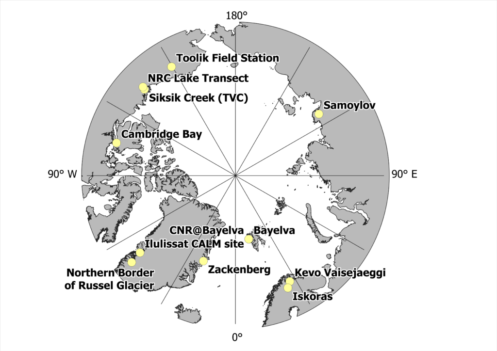
The 2022 circumarctic data set is now published on PANGAEA!
Citation: Boike, Julia; Hammar, Jennika; Goldau, Maybrit; Anselm, Norbert; Chadburn, Sarah; Zwieback, Simon; Martin, Julia; Abramova, Ekatarina N; Coulombe, Stéphanie; Giamberini, Mariasilvia; Rader, Fieke; Herment, Guillaume; Suominen, Otso; Rudd, Daniel Alexander; Mastepanov, Mikhail; Meléndez González, Mayra; Hille, Erika; Elias, Greg; Sjöberg, Ylva; Greschkowiak, Anja; Lee, Hanna; Stuenzi, Simone Maria; Marsh, Phil (2024): T-MOSAiC 2022 myThaw data set [dataset]. PANGAEA, https://doi.org/10.1594/PANGAEA.971586, In: Boike, Julia; Hammar, Jennika; Goldau, Maybrit; Miesner, Frederieke; Anselm, Norbert (2024): Circumarctic seasonal measurements of permafrost parameters (thaw depth, snow depth, vegetation and tree height, water level and soil properties) [dataset publication series]. PANGAEA, https://doi.org/10.1594/PANGAEA.971787